
 iPhone app · free download
Bridge Con, the officer of the watch app for iPhone
The tide, the checklist, the radio procedure and the sight you need on watch, in one app. Offline tide tables for 5,900 ports, 35 bridge checklists, GMDSS distress steps, a COLREG lights identifier and celestial navigation, made by a deck officer and written in plain words.
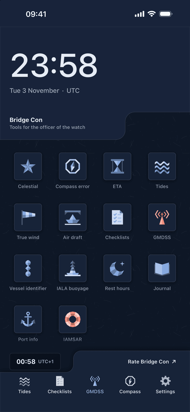
- 5,900tide ports, offline
- 35bridge checklists, 397 points
- 3,000ports with pilotage and plans
- 58stars, plus Sun, Moon and 4 planets
- 3languages: EN · UK · RU
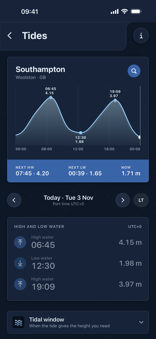
Offline tide tables for 5,900 ports
High and low water, the tide curve and the height of tide now, for any day and any port, with no connection. Bridge Con works the prediction on the phone from each port's harmonic constants, so the tide table never runs out and never needs a download at sea.
- Search by port name, local name or UN/LOCODE. Hamburg, Antwerpen or Rotterdam find every station around them.
- Tidal window: when the tide gives the height you need for under keel clearance or air draft.
- Alerts before high and low water and when the fast part of the rise or fall begins, set for alongside, at anchor or underway.
- Checked against NOAA on 80 ports: median difference 0.3 minutes in time and 1 mm in height.
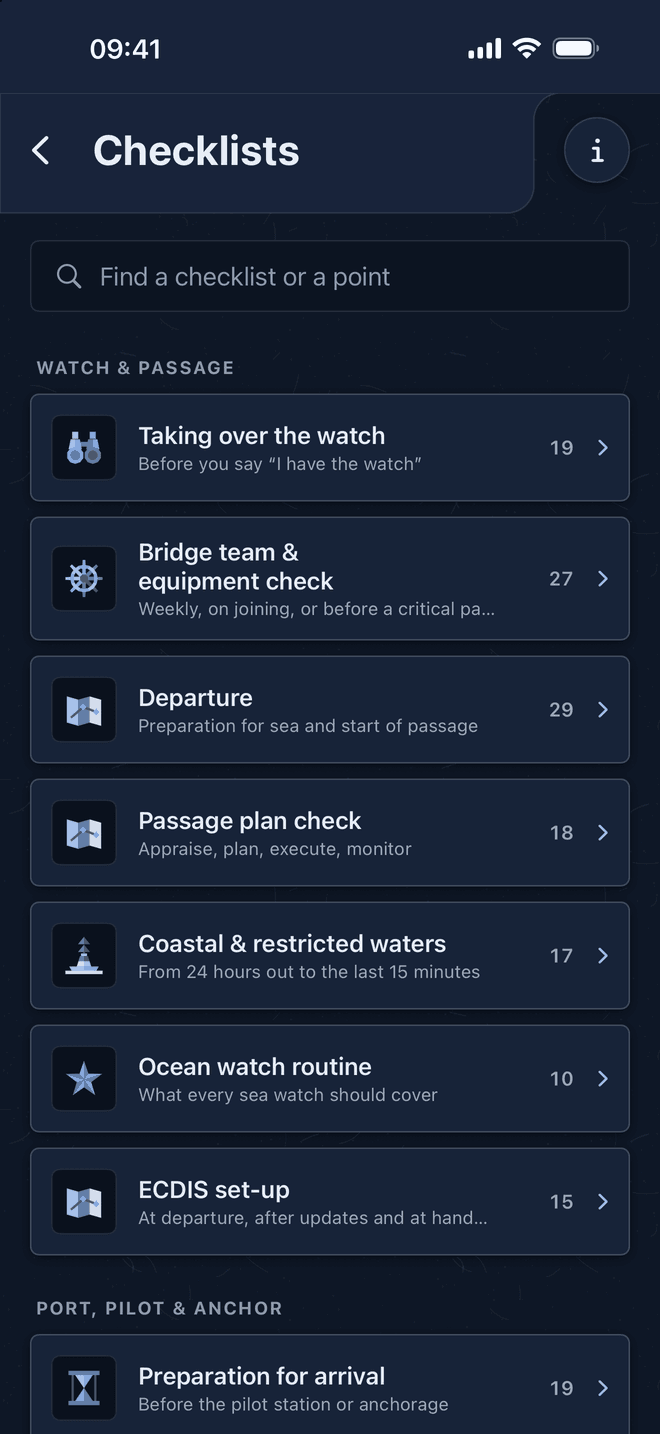
35 bridge checklists you swipe through
Watch handover, departure, arrival, pilot on board, anchoring, restricted visibility, heavy weather and 13 emergency checklists. One point per card, each with a short how-to, so nothing is ticked from memory.
- Swipe right for done, left to postpone. Postponed points come back at the end of the list.
- Goes beyond the usual cards: challenge and response, who has the con, ECDIS look-ahead and alarm tests, abort points in the master-pilot exchange.
- Blackout actions, GNSS spoofing signs and cyber incidents are covered.
- Share the completed record when you finish. A run is kept if you close the app.
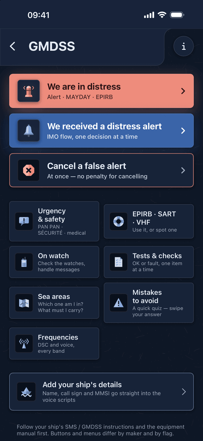
GMDSS distress procedures, one decision at a time
We are in distress, we received a distress alert, or we must cancel a false alert: Bridge Con asks one question per card and your answer picks the next step. It is written from the ITU Radio Regulations, SOLAS chapter IV and the current IMO circulars, in plain words.
- The MAYDAY is written out with your ship's name, call sign, MMSI and position, ready to read into the handset in big text.
- Urgency and safety messages, equipment tests, sea areas A1 to A4 and the frequencies.
- Includes the IMO flow for distress alerts received (MSC.1/Circ.1657/Rev.1).
- Free for everyone, for good.
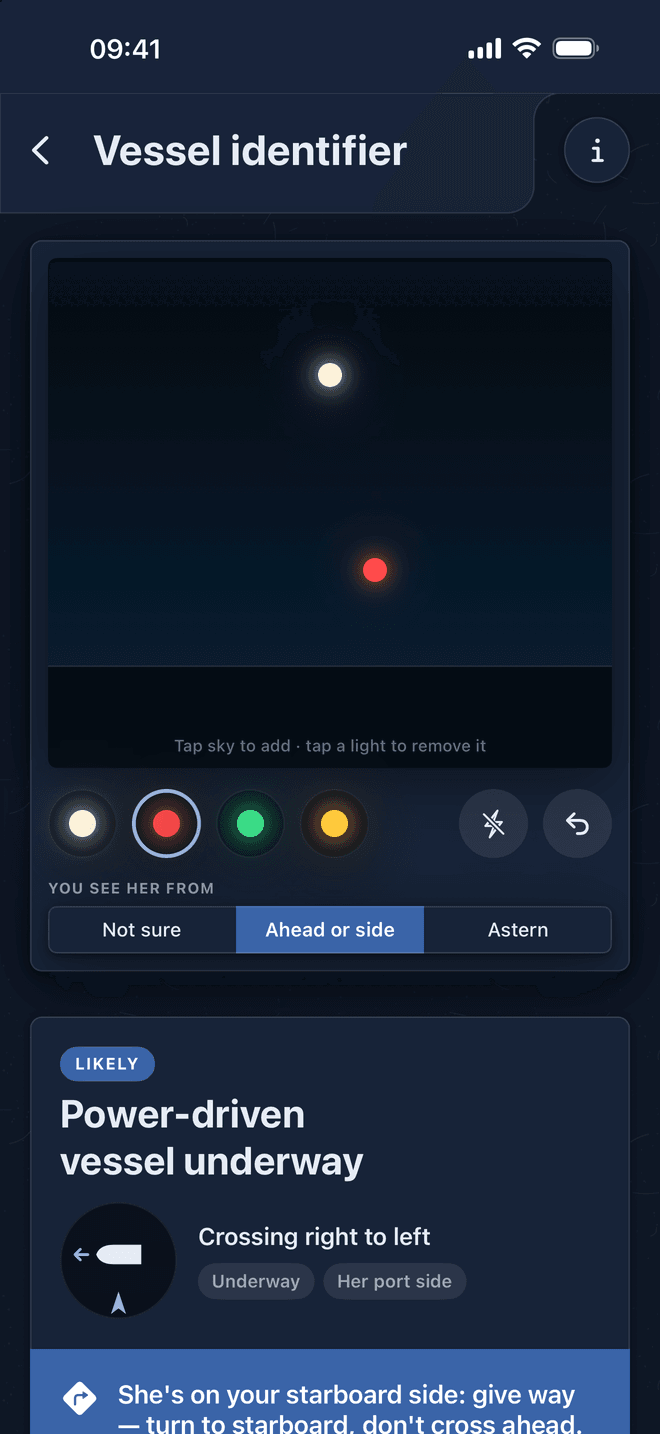
Identify a vessel from her lights (COLREG)
Tap the lights you see on the canvas, one above another as they appear. Bridge Con tells you what the vessel is, which aspect you are looking at and what to do, with the text of the COLREG rule. It is an aid to the lookout, not a replacement for it.
- Masthead, side, stern, all-round and flashing lights.
- The vessel, her heading and her status: towing, fishing, restricted in her ability to manoeuvre, not under command and more.
- Rule text checked against the USCG international text.
- Free for everyone, for good.
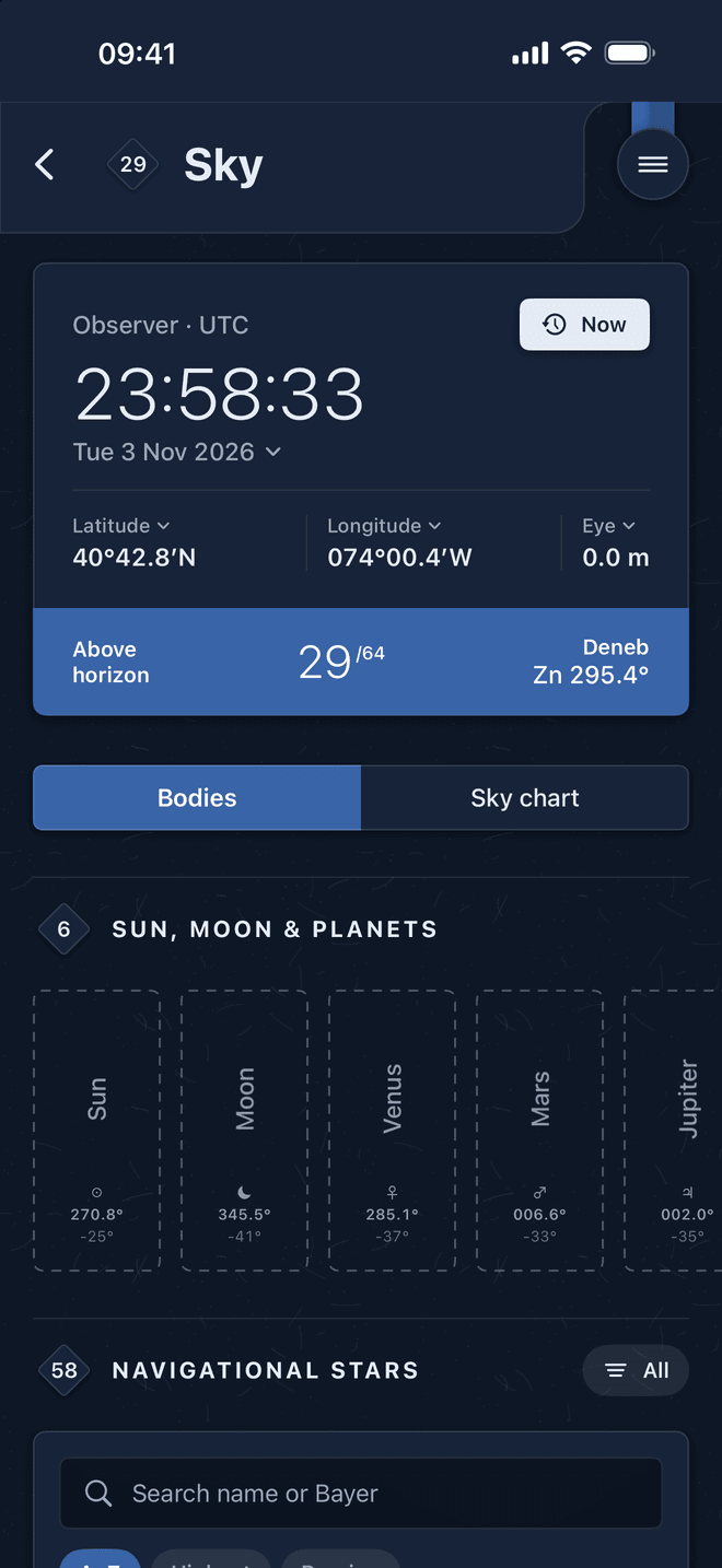
Nautical almanac, ABC tables and sight reduction
An offline almanac and sight-reduction companion for the sextant. See which bodies are up for your DR, work a sight line by line, and take azimuths for compass error, all from the same instant in UT.
- Computed altitude Hc and true bearing Zn for the Sun, Moon, four planets and 58 navigational stars, on a sky chart.
- Hourly GHA, declination, v, d and HP, star SHA and twilight times, like the printed almanac.
- ABC tables, per-second increments and v and d corrections.
- Sight reduction worked by hand, every line shown, so you can find a slip in your own form.
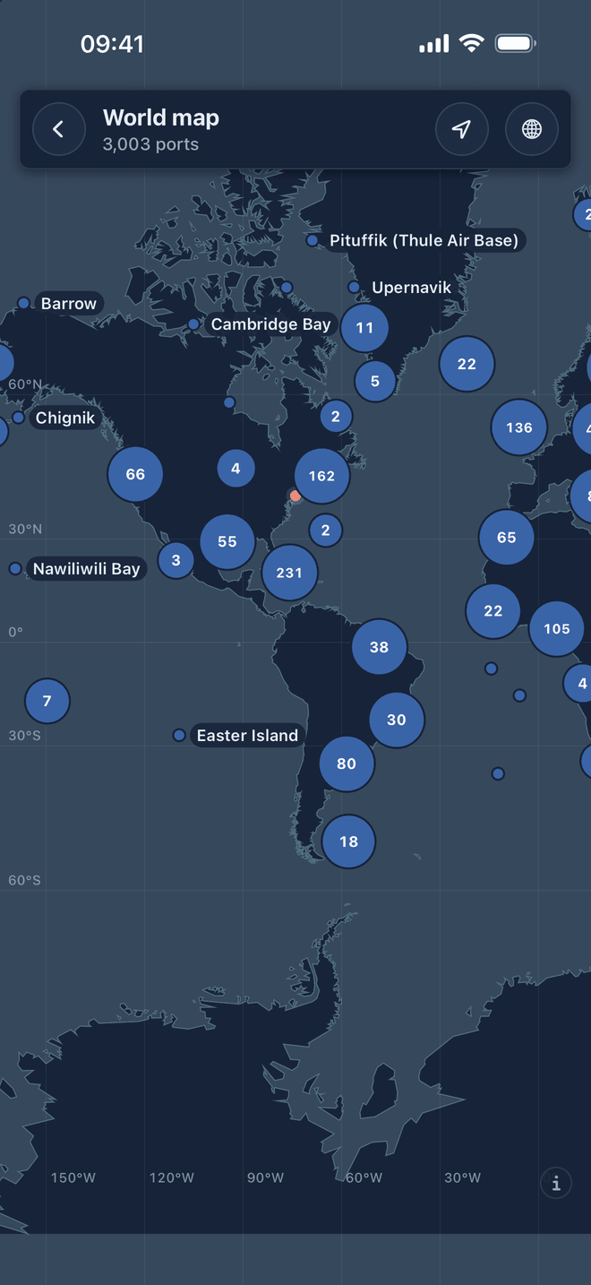
Port information for 3,000 ports
Where the port is, where the pilot boards, how deep the water is and a plan of the port, on a world map that works offline. Built from the World Port Index, UN/LOCODE, OpenSeaMap and published pilotage information.
- Pilotage, the pilot boarding position, VTS and VHF working channels.
- Drafts and depths, and the water density from the World Ocean Atlas, as your hydrometer reads it.
- The port plan, water side only: basins, berths and the fairway. Fetched once per port, then kept.
- Your own notes and hydrometer readings for every port, synced through iCloud.
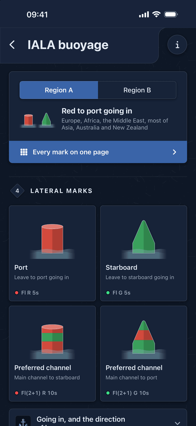
IALA buoyage, regions A and B, by day and night
Every mark of the IALA Maritime Buoyage System as a drawing, with its topmark, its light at night and a photo of a real one. Pick your region and only the lateral marks change, as they do on the chart.
- Lateral, cardinal, isolated danger, safe water, special and emergency wreck marks.
- What to do at each mark, in plain words.
- Every mark on one page, to check which is which or to share as a picture.
- As published in NP735, 8th edition. Drawings and text are the app's own.
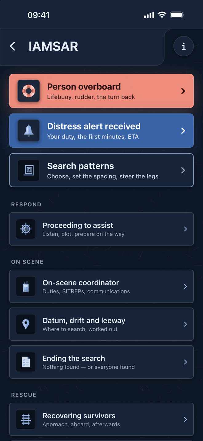
IAMSAR search and rescue, step by step
Person overboard and a distress alert received are on top, because those are needed fastest. Every situation from going to assist to the rescue itself lists what to do in order, what to get ready and what never to do, based on IAMSAR Manual Volume III.
- Williamson, Anderson and Scharnow turns played as animations you can pause or scrub.
- Expanding square, sector, parallel sweep, track line and creeping line searches worked for your own track spacing, speed and courses, with each leg to steer.
- Every word and drawing is the app's own: the IAMSAR Manual on board stays the reference.
ETA, rest hours, compass error and the rest of the watch
The everyday calculations and records of a deck officer, kept in the same app and synced across your iPhones.
ETA
Great circle or rhumb line, with allowances, in ship's time, UTC and port time. Or turn it round for the speed you need to arrive by a set time. Free.
Rest hours (MLC & STCW)
10 hours in any 24 and 77 in any 7, on a rolling window. Fill a month with brushes and watch patterns, then export an inspection-ready PDF.
Compass error book
Gyro and magnetic compass error from an azimuth or a transit, variation from the World Magnetic Model, deviation, and the compass book.
True wind
True wind from the anemometer, heading and SOG on a dial, or from the sea state when the anemometer is out, with the Beaufort force.
Air draft
Air draft from the drafts as read, at the bridge, with trim, hog and sag, and the clearance under a bridge with the tide now.
Private journal
Notes by voice, contract days and leave earned, port calls, document expiry warnings and a water reminder. On your phone only.
Free to download. Pay once, only for the tools you use
GMDSS, the Vessel identifier and ETA are free for good, and every other tool has a free part. Try every tool free for 7 days: no charge, and nothing renews. Then buy single tools, or all of them once for about two thirds of the separate prices. No subscription, no account, no ads.

US prices. The App Store shows the price in your own currency.
| Tool | Price |
|---|---|
| GMDSS, Vessel identifier, ETA | Free |
| 7-day trial of every tool | Free |
| Celestial navigation | $4.99 |
| Tides | $4.99 |
| Bridge checklists | $2.99 |
| Rest hours | $2.99 |
| Port info | $2.99 |
| Compass error book | $1.99 |
| Air draft | $1.99 |
| Journal | $1.99 |
| IAMSAR | $1.99 |
| True wind from sea state | $0.99 |
| IALA buoyage | $0.99 |
Private, offline and in your language
Data not collected
No account, no tracking, no ads. Everything stays on your phone and in your own iCloud.
Synced through your iCloud
Journal, rest hours, compass book and every saved setting follow you to your other iPhones.
English, Ukrainian, Russian
The whole app, checklists and radio procedures included, in three languages.
No subscription
Pay once for the tools you use. Nothing renews, ever.
Built by a deck officer, from the rules themselves
Bridge Con is made by Dmytro Mayevsky, Master Mariner, who also builds the free AMVER report generator, ShipETA Pro and CargoWatch Assistant on this site. Every procedure is written from the published convention, manual or data set, and each tool credits its sources in its own About sheet.
Bridge Con helps the watch. It does not replace the ship's SMS, official charts, tide tables and publications, or the Master's orders.
- Tides: NOAA harmonic constants (US public domain), TICON-4, LINZ and Kartverket constants (CC BY 4.0)
- GMDSS: ITU Radio Regulations 2024, SOLAS chapter IV, IMO MSC.1/Circ.1657/Rev.1, UK MCA, USCG NAVCEN and AMSA guidance
- Rest hours: MLC 2006 Standard A2.3 and STCW A-VIII/1
- Lights: COLREG 1972 international rules, checked against the USCG text
- Search and rescue: IAMSAR Manual Volume III and SOLAS V/33
- Buoyage: IALA Maritime Buoyage System as published in NP735, 8th edition
- Ports: NGA World Port Index, UN/LOCODE, OpenSeaMap and NOAA World Ocean Atlas 2023
- Compass: NOAA World Magnetic Model; ETA meridional parts for the WGS84 spheroid
Bridge Con — frequently asked questions
What is Bridge Con?
Is Bridge Con free?
Does Bridge Con work offline at sea?
How accurate are the tide predictions?
Does it check rest hours against MLC 2006 and STCW?
Which iPhones and languages are supported?
What happens to my data?
Can Bridge Con replace official publications?
Take Bridge Con on your next watch
Free on the App Store for iPhone. Try every tool for 7 days, with nothing to cancel.